Google Kills Earth AI Image Generator After 24 Hours as Critics Flood Maps With Fake Disasters
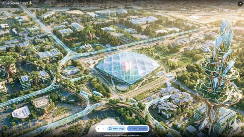
Image: TechCrunch AI
Main Takeaway
Google removed its Nano Banana 2 AI image generator from Google Earth on Friday, just one day after launch, following viral demonstrations of users fabricating fake satellite imagery of refugees, nuclear plants, and bomb craters on real maps.
Jump to Key PointsSummary
The rollout and immediate backlash
Google launched a new feature inside Google Earth on Thursday that let users type text prompts to generate AI imagery superimposed directly onto real satellite, aerial, and 3D terrain data. The tool, powered by Google's Nano Banana 2 image generator, was pitched as a creative way to visualize historical scenes, future construction projects, or conceptual designs anchored to actual geography. The feature went live globally on the web at no additional charge.
Critics pounced within hours. Henk van Ess, a researcher at Digital Digging, demonstrated the tool's darker potential by generating images of refugees near the Mexican border, a nuclear plant in Iran, and a bomb crater near a hospital in Gaza. These fabricated images looked convincingly like real satellite photography, raising immediate alarms about the tool's capacity to produce and spread misinformation at scale. As Ars Technica put it, the reaction boiled down to one question: "What on earth is Google doing?"
How the tool worked and why it was different
Unlike general-purpose AI image generators that start from a blank text prompt, Google Earth's feature used actual satellite, aerial, and 3D terrain data as a structural anchor for every image it produced. This meant the generated imagery was grounded in real-world geography, making the fakes look far more credible than typical AI art. Users could zoom into any location on the planet and prompt the AI to render what it looked like in the past, what a vacant lot could become, or what a building might look like before ground was broken.
Google included some guardrails. The company stated that every image created with Nano Banana 2 in Google Earth included a SynthID digital watermark, and that it prevented image creation on harmful topics. Ars Technica's previous testing confirmed that SynthID can persist through substantial image edits, but also found that the system limits checks to about 10 per day. When Ars prompted Google's Gemini app to run a SynthID check on several AI-modified images generated within Google Earth before the feature was removed, Gemini confirmed it detected digital watermarking indicating the images were generated or edited using Google AI tools.
The speed of the shutdown
Google nixed the feature on Friday, roughly 24 hours after launch. The company's official statement, reported by Bloomberg and The Verge, attributed the rollback to users creating altered satellite imagery that appeared to violate company policies. Google's initial response to van Ess's demonstrations on Thursday had been defensive, noting the watermarking and content guardrails. By Friday, the company had decided those guardrails weren't enough.
The speed of the reversal is striking even by the standards of rapid AI product retractions. The Verge characterized it bluntly: the deepfake tool only lasted one day. TechCrunch noted the feature was rolled out with the stated goal of letting users get creative with geography, but the creative applications were immediately drowned out by demonstrations of the tool's misuse potential.
What the fabricated images proved
The examples generated by Digital Digging served as a near-instant proof of concept for the tool's abuse potential. A single sentence typed into Google Earth could place refugees near the Mexican border, plant a nuclear facility in Iran, or put a fatal crash on a street in Amsterdam. These weren't abstract concerns raised by academics or policy wonks. They were live demonstrations published to the web within hours of the feature going live.
The images looked like genuine satellite photography, which is what made them so dangerous. Standard AI image generators produce output that often has telltale artifacts or stylistic tells. But Google Earth's tool anchored its output to real terrain data, producing imagery that blended seamlessly with the app's existing satellite views. The result was a tool that made it easier than ever to deepfake satellite images, as The Verge noted in its analysis of the problem.
The misinformation risk Google missed
Google's walk-back exposes a tension between the company's rush to integrate generative AI across its product suite and the real-world consequences of doing so in a tool trusted for factual geographic information. Google Earth is used by journalists, researchers, and humanitarian organizations to verify real-world events. Injecting AI-generated imagery into that context undermines the platform's credibility as a source of ground truth.
Ars Technica raised the question of whether Google's policy on preventing harmful image creation was robust enough, given that users immediately found ways to generate politically sensitive and inflammatory content. The SynthID watermarking system, while functional, requires active checking and is rate-limited. In a scenario where fabricated satellite images go viral on social media, the 10-checks-per-day limit means most viewers would never know the images were AI-generated.
What happens to Google Earth's AI ambitions
Google hasn't said whether the feature will return with stronger guardrails or is dead permanently. The company's statement about rolling back the tool due to policy violations leaves both possibilities open. The underlying technology, Nano Banana 2, remains live in other Google products, and the concept of grounding AI imagery in real geographic data is technically interesting enough that Google likely wants to salvage it.
The episode also raises questions about Google's internal review processes for AI product launches. A feature that let users paste arbitrary AI imagery onto real maps should have triggered obvious red flags during development and testing. That it launched at all, even for a single day, suggests Google's AI safety review pipeline has gaps when it comes to anticipating misuse scenarios that are simple and predictable rather than technically exotic.
The broader context for AI and misinformation
The Google Earth incident lands at a moment when AI-generated imagery is already eroding trust in visual evidence across the internet. General-purpose image generators have been used to create fake news photos, political propaganda, and non-consensual imagery. What makes the Google Earth case distinct is the specific credibility that satellite imagery carries. People trust satellite photos in a way they don't trust random images on social media, because satellite imagery feels like objective documentation.
By letting users generate fake satellite images that inherit that credibility, Google inadvertently built a tool that could supercharge a particular strain of misinformation that is especially hard to debunk. The quick reversal suggests Google recognizes the severity of the problem, but the fact that the feature shipped at all indicates the company is still struggling to anticipate how its AI tools will be used in practice, not just in theory.
Key Points
Google removed the Nano Banana 2 AI image generator from Google Earth on Friday, July 31, 2026, roughly 24 hours after its global launch.
Digital Digging researcher Henk van Ess demonstrated the tool generating fake satellite imagery of refugees, a nuclear plant, and bomb craters within hours of launch.
The feature anchored AI imagery to real satellite and terrain data, making fabricated images far more credible than standard AI-generated photos.
Google's safeguards included SynthID digital watermarking, but detection checks were rate-limited to about 10 per day, making at-scale verification impossible.
The rapid reversal exposed gaps in Google's internal AI safety review process for products where misuse scenarios are simple and predictable.
Questions Answered
Google removed the Nano Banana 2 AI image generation feature from Google Earth on July 31, 2026, just one day after launching it. The tool allowed users to generate AI imagery and overlay it on real satellite maps, but Google pulled it after users created fake images of disasters, refugees, and other misleading content that violated the company's policies.
The feature used Nano Banana 2, Google's AI image generator, and grounded its output in real satellite, aerial, and 3D terrain data. Users could zoom into any location on the planet, type a text prompt, and generate AI imagery that was anchored to that specific geography, making the results look more realistic than standard AI-generated images.
Researcher Henk van Ess of Digital Digging demonstrated the tool by generating images showing refugees near the Mexican border, a nuclear plant in Iran, and a bomb crater near a hospital in Gaza. These images were created with simple text prompts and looked convincingly like real satellite photography.
Yes, Google said every image created with Nano Banana 2 in Google Earth included a SynthID digital watermark. The company also stated it prevented image creation on harmful topics. However, Ars Technica found that SynthID checks were limited to about 10 per day, limiting practical verification at scale.
Google has not announced whether the feature will return with stronger safeguards or is permanently removed. The company's statement said the rollout was rolled back because users created imagery that appeared to violate company policies, leaving the door open to a future relaunch with additional restrictions.
Source Reliability
57% of sources are highly trusted · Avg reliability: 78
Go deeper with Organic Intel
Simple AI systems for your life, work, and business. Each one includes copyable prompts, guides, and downloadable resources.
Explore Systems